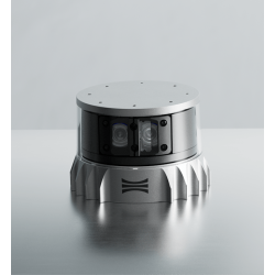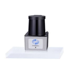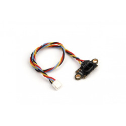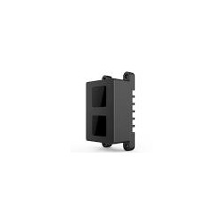
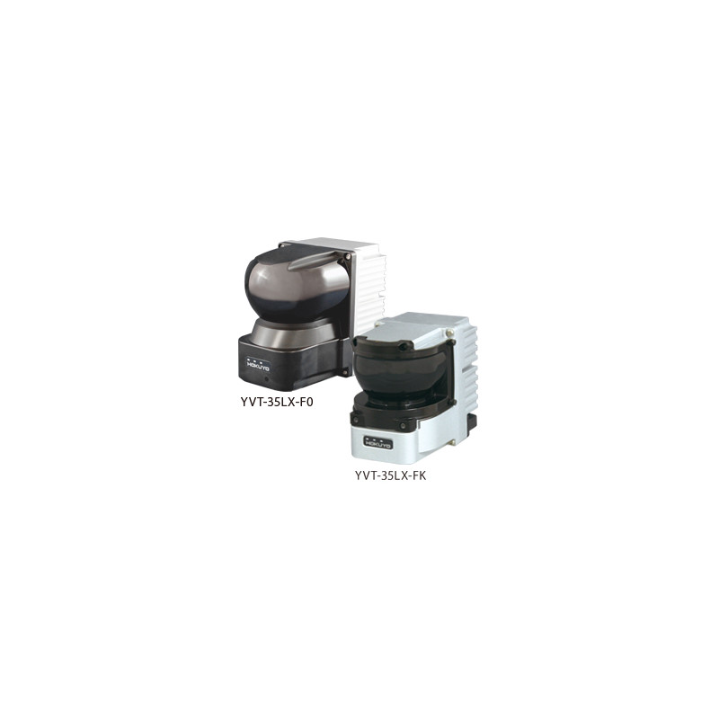
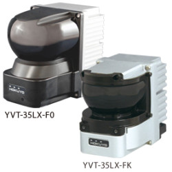
Hokuyo YVT-35LX-F0 / YVT-35LX-FK
The Hokuyo YVT-35LX is an industrial 3D LiDAR / 3D Scanning Range Finder laser scanner designed for measuring distances and creating three-dimensional point clouds.
Measurements are performed using the Time of Flight (TOF) method, based on the return time of a laser pulse reflected from an object.
The laser beam is steered both horizontally and vertically, allowing the sensor to obtain information about the width, height, and depth of observed objects.
The field of view is at least 210° horizontally and 40° vertically.
Hokuyo YVT-35LX-F0 / YVT-35LX-FK
The Hokuyo YVT-35LX is an industrial 3D LiDAR / 3D Scanning Range Finder laser scanner designed for measuring distances and creating three-dimensional point clouds.
Measurements are performed using the Time of Flight (TOF) method, based on the return time of a laser pulse reflected from an object.
The laser beam is steered both horizontally and vertically, allowing the sensor to obtain information about the width, height, and depth of observed objects.
The field of view is at least 210° horizontally and 40° vertically.
One standard frame contains at least 2,590 measurement points.
The sensor features an interlacing mode, which gradually shifts the laser emission position between successive scans, significantly increasing the point cloud density.
In HD mode, at least 518,000 points can be acquired. The sensor supports Multi-Echo, which captures multiple reflections of the same beam – up to four reported echoes.
Multi-Echo can help distinguish real objects from reflections caused by factors such as rain, fog, dust, or protective housing.
The device has a built-in acceleration and angular velocity measurement module based on the InvenSense MPU-6500.
A PPS (Pulse Per Second) input is available, enabling time synchronization, for example, with a GPS receiver.
Data is transmitted via 100BASE-TX Ethernet.
The manufacturer offers two variants: the standard YVT-35LX-F0 and the quiet YVT-35LX-FK (Quiet Type).
Technical Specifications
Device Type: 3D Scanning Range Finder / 3D LiDAR.
Models:
-YVT-35LX-F0 – standard version,
-YVT-35LX-FK – quiet type version.
Measurement Technology: Pulsed Laser / Time of Flight.
Light Source: 905 nm laser diode.
Laser Safety Class: Class 1 according to IEC 60825-1:2007 and IEC 60825-1:2014.
Nominal Power Supply Voltage: 12 V DC / 24 V DC.
Operating Voltage Range: 10–30 V DC.
Current Consumption at 12 V:
- Startup: approx. 1.5 A,
- Normal Operation: approx. 0.8 A.
Horizontal Field of View: ≥210°.
Horizontal scan step: 6° in the basic scan system.
Horizontal angle accuracy: ±0.125°.
Vertical field of view: 40°.
Vertical range: -5° to +35°.
Vertical angle accuracy: ±2°.
Basic point count: ≥2590 points/frame.
Basic frame rate: 20 fps.
HD interlacing mode: ≥518,000 points.
Frame rate in maximum HD mode: 0.1 fps.
Horizontal interlacing: maximum 20×.
HD mode: maximum 20× horizontal × 10× vertical.
Measurement range
For the central part of the vertical scan (+15°):
for the horizontal direction -45° < θ < +45°:
- white object: 0.3–35 m,
- black object with 10% reflectivity: 0.3–11 m;
for a range of approximately 45–75° from the axis:
- white object: 0.3–20 m,
- object with 10% reflectivity: 0.3–6 m;
for the extreme directions, above approximately 75° from the axis:
- white object: 0.3–10 m,
- object with 10% reflectivity: 0.3–3 m;
at the extreme vertical scan angles (+35° / -5°), the range is approximately 70% of that obtained for the central vertical position.
Important: The "35 m" designation often given for YVT refers to the maximum range under favorable conditions and for a bright target in the central sector. 35 m should not be considered a guaranteed range for the entire 210° × 40° field.
Measurement Accuracy
Accuracy for a white object in the central sector at a temperature of 25°C:
- Below 15 m: ±50 mm,
- Above 15 m: ±100 mm.
Repeatability:
- Below 15 m: σ <20 mm,
- Above 15 m: σ <35 mm.
The manufacturer notes that accuracy values are checked in the forward direction during factory inspection.
Range and accuracy may vary depending on the measurement direction.
Very weakly reflective surfaces may not be detected in some distance ranges.
Multi-Echo
Supports up to 4 reported echoes per measurement direction.
The sensor can internally process up to 8 echoes, of which four are reported.
The first, second, third, and last echoes are available.
This function is particularly useful in the presence of:
- rain,
- fog,
- dust,
- aerosols,
transparent or semi-transparent objects in front of the target.
However, this does not mean the sensor is completely immune to adverse weather conditions – the manufacturer clearly states that rain, snow, fog, or dirty optical windows can destabilize the measurement.
Communication and Synchronization
Interface: Ethernet 100BASE-TX.
Communication: TCP/IP.
Ethernet Auto-Negotiation.
Communication Protocol: VSSP 2.1.
Synchronization Input: PPS Input.
PPS can be used, for example, in conjunction with GPS to eliminate drift in the sensor's internal clock. Available synchronization output: SYNC OUT, photocoupler open collector.
Maximum output parameters: 30 V DC / 50 mA.
The manufacturer provides a separate Communication Protocol Specification for the YVT-35LX, allowing you to create your own software that communicates with the sensor.
Environmental Conditions and Design
Operating Temperature: -10°C to +50°C.
Humidity: up to 85% RH, non-condensing and non-freezing.
Maximum declared ambient illumination: 100,000 lx.
Avoid direct sunlight on the sensor.
Vibration resistance: up to approximately 10 G within the manufacturer's specified test range.
The manufacturer states an IP67 protection class, but also includes the important disclaimer "Power supply is off / Not waterproof" with this parameter.
For this reason, I would not describe the YVT-35LX in its product range as a fully waterproof sensor without further explanation or confirmation from the manufacturer. The sensor is not certified for functional safety.
The manufacturer expressly states that the device cannot be considered a certified safety sensor for detecting people in accordance with the requirements of the Machinery Directives.
Dimensions and Weight
YVT-35LX-F0:
Dimensions: 70 × 106 × 95 mm (W × D × H),
Weight: approximately 650 g,
Noise level: approximately 53 dB at 1 m.
YVT-35LX-FK – Quiet Type:
Dimensions: 76 × 106 × 95 mm,
Weight: approximately 1 kg,
Noise level: approximately 47 dB at 1 m.
The FK is approximately 6 dB quieter than the F0, according to the manufacturer's measurements.
The LiDAR parameters of both variants are shared on the manufacturer's website; the main claimed difference is the quieter design, along with the increased weight and width of the device.
Startup
After turning on the device, approximately 60 seconds of warm-up/startup are required.
Measurement data is not available during this period. Stabilization of the vertical scanning mechanism requires approximately 2–3 minutes. This is a significant limitation in applications where the sensor should be fully operational immediately after power is applied.
Cables
The power cable is not included as an integral part of the sensor by default; the manufacturer specifies it as an option.
Available power cables:
YVT-C003 – 3 m,
YVT-C005 – 5 m.
An Ethernet cable is also optional:
YVT-ENET003 – 3 m,
YVT-ENET005 – 5 m.
The Ethernet cable uses a waterproof M8 connector on the sensor end, while the network end is terminated with an RJ45 connector.
Other models:
Hokuyo YHT-10LA
a newer 3D LiDAR sensor,
maximum measurement area of approximately 10 m under guaranteed conditions,
maximum detection distance up to 15 m,
field of view 45° horizontal × +40°/-45° vertical,
scan time without interlacing 17.5 ms,
allows the definition of three-dimensional detection zones without the need to create a custom area algorithm,
has filters designed to reduce the impact of dust, rain, and fog,
however, it is not a functionally certified safety sensor.
Hokuyo UTM-30LX-EW
2D LiDAR sensor, therefore not a direct replacement for the YVT,
guaranteed range up to 30 m,
maximum measurement range up to 60 m,
270° field of view,
Ethernet,
Multi-Echo,
IP67,
a sensible alternative if the application requires only flat 2D scanning.
Hokuyo UTM-30LX
2D LiDAR,
range up to 30 m, maximum 60 m,
270° field of view,
angular resolution 0.25°,
full scan time 25 ms,
USB 2.0 interface,
more compact and simpler for robotic applications when 3D information is not required.
Hokuyo UXM-30LXH-EWA
Industrial 2D LiDAR designed for harsher environments,
Range up to approximately 30 m,
190° field of view,
Angle resolution of approximately 0.125°,
Multi-Echo,
Built-in heater,
Ethernet,
IP67,
Particularly interesting for use in harsher outdoor conditions.
Hokuyo YVT-35LX-F0 / YVT-35LX-FK
The Hokuyo YVT-35LX is an industrial 3D LiDAR / 3D Scanning Range Finder laser scanner designed for measuring distances and creating three-dimensional point clouds.
Measurements are performed using the Time of Flight (TOF) method, based on the return time of a laser pulse reflected from an object.
The laser beam is steered both horizontally and vertically, allowing the sensor to obtain information about the width, height, and depth of observed objects.
The field of view is at least 210° horizontally and 40° vertically.